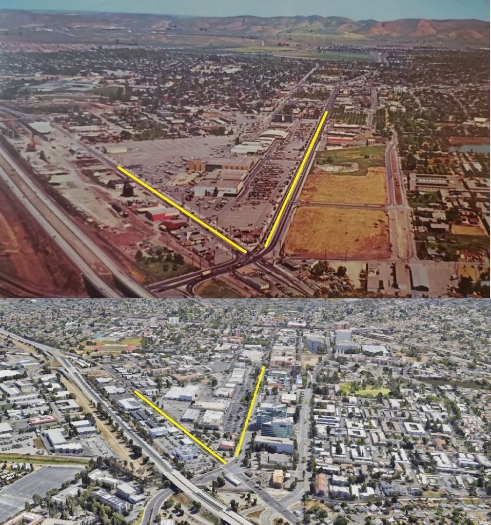
Here’s a photo of Concord in the 1950s/60s (top) and a current photo of Concord from 2024ish (bottom, courtesy of google).
Click on the photo for a larger view to compare the two. The yellow line on the right is Willow Pass Rd., and the yellow line on the left is Market St.
It sure has changed.


I believe this is about 1970 +/- a few years.
Way to go city council, you must be proud.
LOU,
.
They are proud of themselves for all development that they approve, but if Concord citizens had to vote to approve development projects then we’d have a much different city. Have you seen how they beam with pride when speaking about development projects they’ve approved or have been completed? It’s really strange!
@ Black Night
I totally agree.
Probably a bit after 1962 when 242 was built into 4-lane highway. Note that there’s really no landscaping to speak of alongside it.
…. that’s progress? 🙁
I think the older picture is from the 1970s, possibly even the late 1970s. The Fry’s building was constructed in 1979 and is not in the picture and so the picture was taken before then.
I looked again and am revising my estimate to between 1967 to to 1969 based on the area around where Fry Way was later added.
It looks like the 50s or 60s to me. Looking at the size of the parked cars, they are too small for the 70s. In the 70s, American cars were bigger and there were a lot of vans, and pickup trucks, some with camper shells and some with four-wheel drive.
Curious, the distance between market Street and 242 is about half in the newer photo, did market street get moved over, or 242? Noticed sizable difference in the space between lanes of 242 as well……
@Crazytech – the scale and altitude and tilt angle of the two photos is different. The highways were widened by removing the center median landscaping and replacing it with a cement wall which gave them room to add a lane or two towards the middle.