
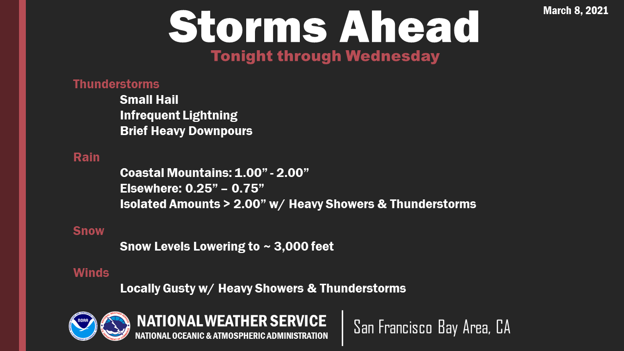
Unsettled weather conditions return to the region later today and continue through at least Wednesday afternoon, according to the National Weather Service.
Chances of thunderstorms will increase during the day Tuesday and will continue into Wednesday with the potential for small hail, infrequent lightning, gusty winds and brief heavy downpours. Snow levels will also begin to lower to around 3,000 feet Tuesday into Wednesday with the possibility of accumulating snowfall in the region’s higher peaks/ridges, including Mt. Diablo.
Rainfall amounts will vary widely due to the convective nature of this weather system. However, look for totals through midweek of one to two inches in the coastal mountains with one-quarter to three-quarter inch elsewhere.
Precipitation will begin to diminish late Wednesday night and mostly come to an end by Thursday morning.
9 comments
Welcome news but I won’t turn off the outside water for a while yet.
.
Just make it dry on the weekends!
.
Not a storm, just another weather front.
This year has seen some pretty anemic rain events. This appears to also fall into the wimpy category. I believe it’s a negative 3 on the storm impact scale.
No it’s not, the weather people can’t even predict the sun coming up, rain forecasting is out of their scope of education
OK….where is the storm? These weather people aren’t very good, are they? I agree with Singledout
The rain band from yesterday and last night, had a probability of hitting the Bay Area, but its trajectory changed and went slightly north. It did rain, just not here in Concord.
There was another band of rain that made land fall in the Santa Cruz/Monterrey region.
The key words in the weather report were “unsettled weather” and “convective nature”. Nothing was guaranteed to happen here in Concord. Rain bands were seen on radar, but they were moving around.
… will believe it when I see it – we’ve had so many false alarms on storms this year… wish I was a weather forecaster – you can be wrong 80% of the time and still keep your job!
Check back around 1-2pm. Unsettled weather means small pockets of cold unstable air makes isolated small storms. Rotating in through today and tomorrow. Try using Windy.com not hard to use and see what is going on. Nobody said major storms just some small isolated showers and chance of small isolated thunder storms. Look at windy I’d say forecast is accurate.
https://www.windy.com/-Satellite-satellite?satellite,34.162,-117.751,5
Comments are closed.